Rock Beats
Introducing a New and Improved CityView
The IT – Geospatial Services Team is proud and excited to present a new and improved version of CityView with added features, reliability and accessibility.
The original iteration of CityView was launched in 2013 to address limitations that users had while using third-party software. In fact, the Information Technology Department won an Excellence Award for CityView, the City’s first in-house GIS web interface, which you can read about here.
While CityView has provided users with a decade’s worth of in-house data and web-based mapping capabilities, it’s no longer able to meet the expanding needs of our users.
Why a new CityView?
The City of Round Rock has grown in many ways in the last decade, especially in terms of its technology and GIS capabilities, which is why we felt it was time for a new solution to better suit the needs of our fast-growing city.
We created a new version of CityView to modernize the underlying framework that the original CityView was built with. The original application was written using a programming language that is no longer updated, and had a complex and time consuming system for updating and modifying the GIS data. Additionally, the User Interface had become dated and difficult for users to navigate. With the new CityView, we are now able to rely on up-to-date software and practices, as well as simplify the process for updating the data.
What’s new?
Some of the major changes include:
- A modernized interface that includes a responsive mobile layout
- A new custom Search Layers tool to simplify users’ workflows
- Reworked layer groups, popups, and symbology for all feature layers
- A new Resources tab that allows users to navigate to other GIS resources
- Updated Address Checker application
The new CityView was piloted by Ariana Bernal, GIS Technician who had this to say about the end product:
“Some of the features I am most excited about are the Resources tab, which serves to connect users with other GIS resources such as our GeoHub, the Address Checker application, and Round Rock’s ArcGIS Online site.”
Salih Horozovic, Systems Administrator also contributed extensively to this project. He created the Search Layer tool that proved to be a challenge to create, but something we believe will greatly improve the usability and ease with with our users interact with CityView.
Using the App
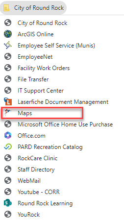
To see the new CityView, simply click on Maps from the City of Round Rock folder that’s bookmarked on any browser on the City’s network:
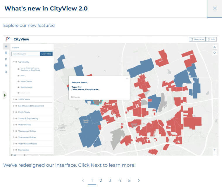
When you first navigate to CityView from a desktop, you’ll be met with an introductory guide that will show you how to access and utilize all of the new features that we’ve configured! The guide will walk you through using the map toolbar, accessing and searching GIS layers, navigating the new Resources tab and more. You can also access this introductory guide at any time by clicking the “Info” button in the top right corner of the page.
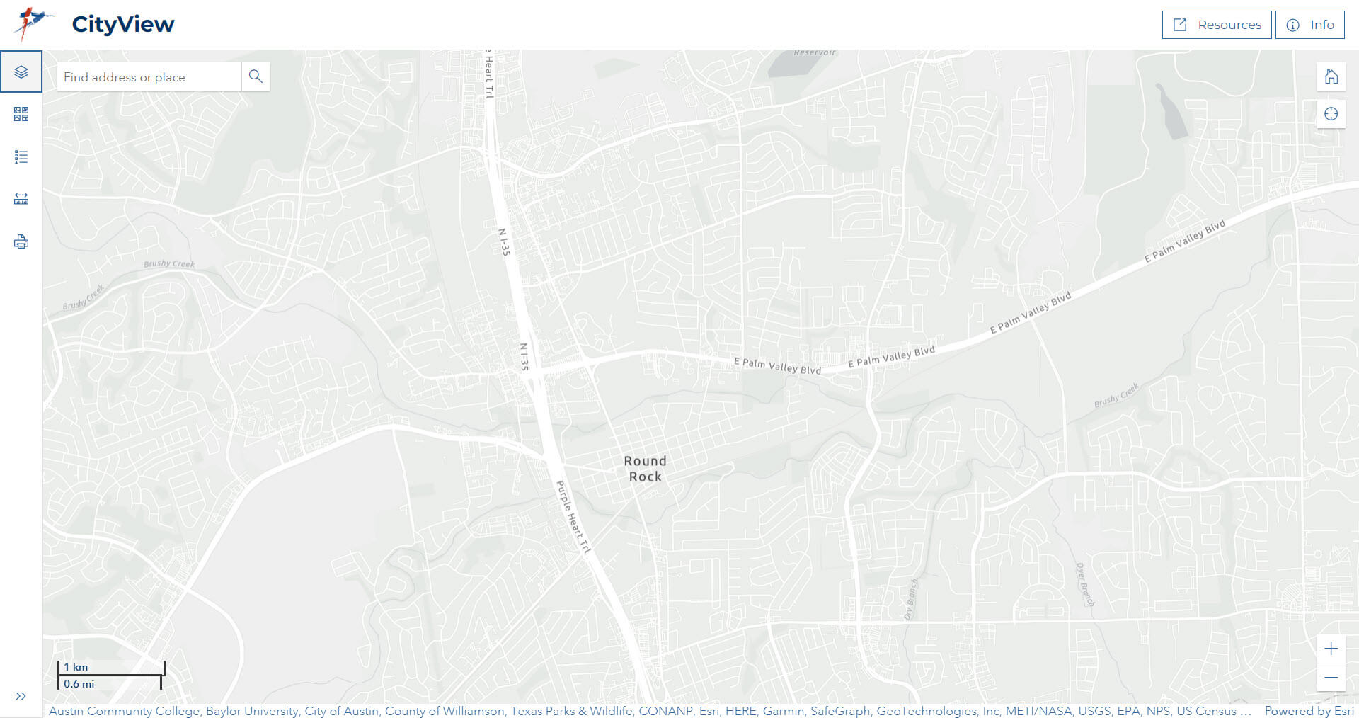
CityView now has a modern and refreshed interface on both desktop and mobile screens:
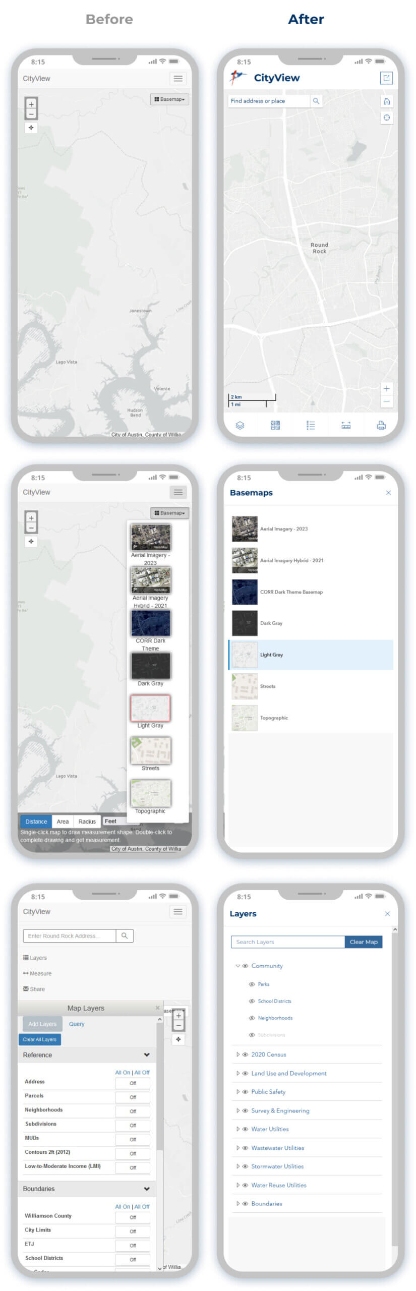
Check out the images below for a mobile view comparison of the original CityView and the new and improved CityView!
Questions?
If you have any trouble at all using the new CityView, don’t hesitate to reach out to the IT – Geospatial Services team by submitting a Support Ticket, we are happy to assist or answer any questions you may have regarding CityView, or anything GIS!