Rock Beats
IT Department wins Excellence Award

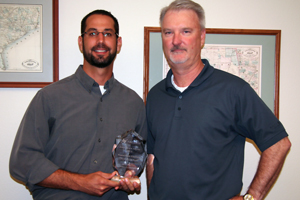
Ramsey Saad and Chris Collier with the Excellence Award
Round Rock’s IT Department was honored with an Excellence Award at the Texas Association of Governmental Information Technology Managers (TAGITM) Conference in April for CityView, its GIS web interface.
Custom fit
The CityView section of the City’s website – http://maps.roundrocktexas.gov/cityview/ – is a GIS web interface that allows City information to be presented in a familiar, useful format – a map – that can be viewed on a wide array of devices including mobile phones and tablets.
“What makes us stand apart from other agencies is that we developed this web interface in house,” says Ramsey Saad, systems administrator. “We aren’t using a third party solution. It is completely customized and tailored to our needs.”
CityView allows custom implementations that meet the specific goals and needs of departments.
“We have a lot of GIS data that our team works hard to maintain,” says Ramsey. “That’s why a good web interface was so important. We wanted to get that information out to users in a way that is familiar and easy to use.”
The City’s GIS team was not happy with the available third-party web interface solutions for GIS data.
“The available third-party web interfaces were not keeping up with what was available on other websites,” says Ramsey. “We were seeing the private sector putting out custom products that were fast, user-friendly and dynamic while the GIS products were stuck in old modes of thinking about the web. That’s why we started to develop our interface.”
Enter once – Share everywhere
“CityView integrates many different sources of information – City data, public sources – to get a best of breed product that has the completeness of commercial map vendors but the accuracy of the City’s GIS information,” says Ramsey. “It also gives us an easy way to present information that the public needs.”
CityView continues to expand and add functionality. For example, the Utilities and Environmental Services Department recently started using a software called TRAKiT to help manage CIP projects. CityView can access data from the TRAKiT system and present it to the public in a map format. The website is kept up-to-date seamlessly and project managers need to enter the data only once.
“Employees and the public can see the outlines of the CIP project on the map and with just a click can pull up project information such as timelines and descriptions,” says Chris.
As the IT department continues to move information and processes into third party database management systems such as TRAKiT, CityView will continue to be a platform for integrating these various sources of data to display the information in an easily consumable manner.
CityView is used throughout the City and by the public to access information from the Fire Department, Planning, Utilities and Environmental Services, Parks and Recreation, FEMA, US Census Bureau, and more in an easy to use format.
“We get lots of comments from the public wishing other cities had something like CityView,” says Chris.
Mobile web
CityView is also accessible across browser platforms and on mobile devices. This is another advantage over available third party web solutions which are designed to be accessed on desktop computers. As mobile phones and tablets become more common, CityView’s accessibility becomes more important.
“We wanted to implement a web mapping interface that would be user-friendly to a broad audience and work on the devices that employees and residents are using more and more,” says Ramsey.
About TAGITM
The Texas Association of Governmental Information Technology Managers is a not-for-profit organization that provides information systems professionals a forum for generating ideas, sharing problems, and developing solutions.
