Rock Beats
Introducing EagleView: Ortho and Oblique Imagery Viewer and What It Can Do for You
We are excited to announce and share EagleView, a new software available to city staff. We believe this software can serve as an invaluable asset for various departments. Read on to find out how EagleView may benefit your team.
What is EagleView?
EagleView is an imagery and analytics software which provides high resolution ortho and oblique imagery. EagleView also offers a range of built-in tools, software add-ins, and integrations with other city software to best serve your imagery needs.
Orthoimagery vs. Oblique Imagery
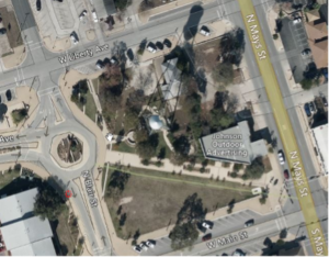
Orthoimagery – is a top-down, bird’s-eye view of imagery. This is what you typically see in most maps and applications.
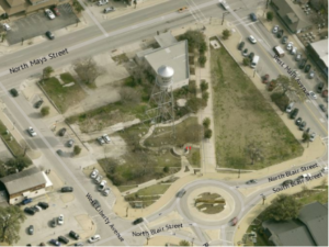
Oblique Imagery – Aerial photography which is collected at an angle, usually downward at a 40° to 50° angle to the ground to provide a “side view” for buildings and other features.
What can EagleView do for me?
Depending on your needs, EagleView imagery can be an asset in a range of use cases. From event planning to GIS analysis tool expansion, to high resolution image referencing, there are several assets the software can provide. Below are some examples of how EagleView may benefit your department.
| Police |
|
| Fire |
|
| Emergency Response |
|
| Planning |
|
| Utilities & Transportation |
|
Types of EagleView Software Available:
Depending on your needs, the following EagleView applications are available
EagleView Online Explorer: The EagleView online explorer serves as the primary application and allows you to explore current and historic imagery in high resolution with a full range of tools including measurement, identification, side-by-side imagery panels, and more. If you’d like an account, please submit a help desk ticket and IT will be more than happy to get you setup.
EagleView Mobile Application: The EagleView mobile imagery viewer provides the same set of imagery with a minimal toolset for referencing out in the field. This can be downloaded in Apps@Work.
EagleView Add-in for ArcGIS Pro: This add-in integrates EagleView aerial and oblique imagery as well as the full set of tools on their online explorer to use with your ArcGIS Pro Projects. Some tools and functionalities available are imagery extraction, GIS layer identification, and side-by-side aerial and oblique imagery comparison.
To install follow the following article ArcGIS Pro – Install EagleView Add-In
To Learn More About EagleView, visit eagleview.com