Rock Beats
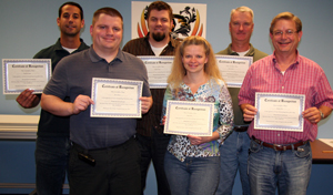
GIS receives Innovations Award for GeoPortal

The Round Rock GeoPortal was developed in house using the latest Microsoft, ESRI and web technologies to deliver a rich user experience interacting with geographic information systems data maintained by the Round Rock GIS department. It is much more flexible and easier to use than the previous GIS web application.
“ESRI is the company that provides the desktop solution for GIS services throughout the industry,” says Ramsey Saad, GIS analyst. “In the past, their web solution was template based and pretty restrictive. All city GIS departments had a similar look for their web mapping application and there wasn’t a whole lot that could be done customize it.”
About two years ago, ESRI shifted its approach to the web and began providing application programming interfaces (API) that allow its clients a new level of control over their web-based applications.
“With API, the vendor provides a way to actually develop custom web applications,” says Ramsey. “You can control the look and feel. However, it entails a lot of programming.”
Initially, Ramsey planned to use the new tools to create a Fire view application to enhance the existing system. When GIS Coordinator Chris Collier saw the results, he realized the custom application was the way to go for all the GIS information on the web.
Enriching the experience
The GeoPortal was developed entirely in-house over about 6 or 7 months. It uses Microsoft Silverlight technology, which allows for rich graphics, video and animation.
“Silverlight is perfect for mapping applications,” says Ramsey. “It allows you have a nice looking interface and gives you animation effects to make your user interface more intuitive. It also streams video well so we can embed videos in maps right out of the box.”
The GeoPortal takes advantage of all of these features to make the map-viewing experience far more enjoyable and user friendly.
“We redid our maps that we publish out on the web,” says Ramsey. “We can do some really beautiful maps over the web now.”
The new GeoPortal is substantially faster than the previous web application as well. It is also robust enough that it can handle the mapping needs of employees who in the past would have needed ArcGIS software installed on their computers, saving the cost of licensing fees and installation and maintenance for the software.
Perhaps most importantly, the new GeoPortal can be customized as needed.
“The new application is much more flexible,” says Ramsey. “We can control the way we want to show information. If something doesn’t work, we can change it.”
Innovations Award
The Innovations Award recognizes City employees who have implemented any project that is fresh, creative or inventive and that saves time, saves money, improves morale, performance, safety, service to customers or the community.
If you have a project you’d like to be considered for the award, contact Shannon McIntire at x407 or one of the Innovations Team members.
Pictured: (From left) Ramsey Saad, Steve Byrd, Kelly Farley, Kim Jones, Chris Collier and Randy Hitt.
